


A study recently published in the journal Nature Communications It shows that global warming in the Canadian High Arctic has profoundly modified river network structure in just 60 years.
By documenting the interplay between climate change, soil freeze-thaw dynamics, and surface water inputs through floods and snow and ice melt, researchers at Simon Fraser University and the University of British Columbia have developed new insight into the physical controls that govern the speed and pattern of river channel development in these fragile landscapes.
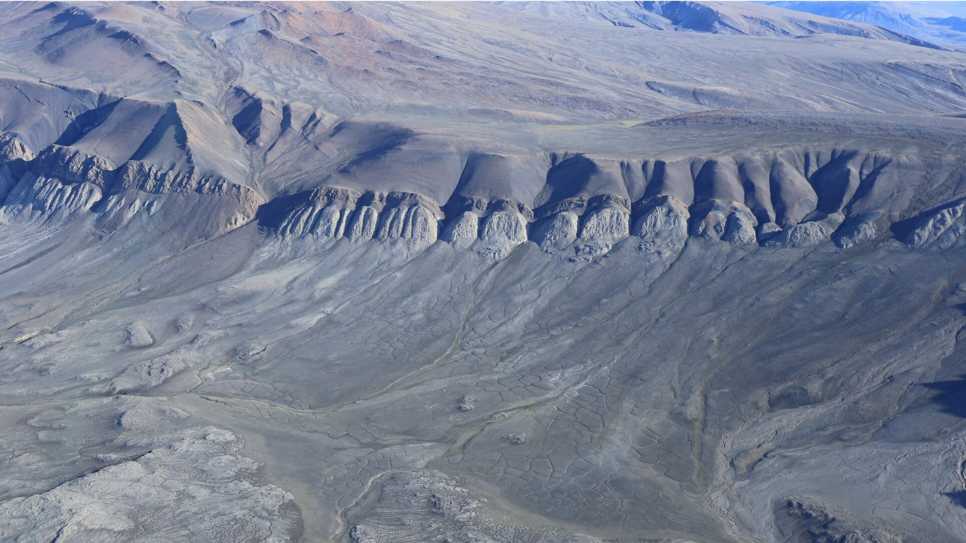
“One of the key processes we have identified in the evolution of stream networks is that their development is influenced by the way water flows across fields of polygons about 10 meters wide. Large, created by the freezing and thawing of land in Arctic regions.” explains Sean Chartrand, a professor at Simon Fraser University and lead author of the study
This effect also depends on the timing, size and duration of floods, as well as on whether the underlying sedimentary particle substrates are frozen or partially frozen, he says. “Interconnected physical processes can deepen river channels and expand river networks, creating a greater surface area for heat exchange, which may increase local permafrost melting rates,” says Chartrand.
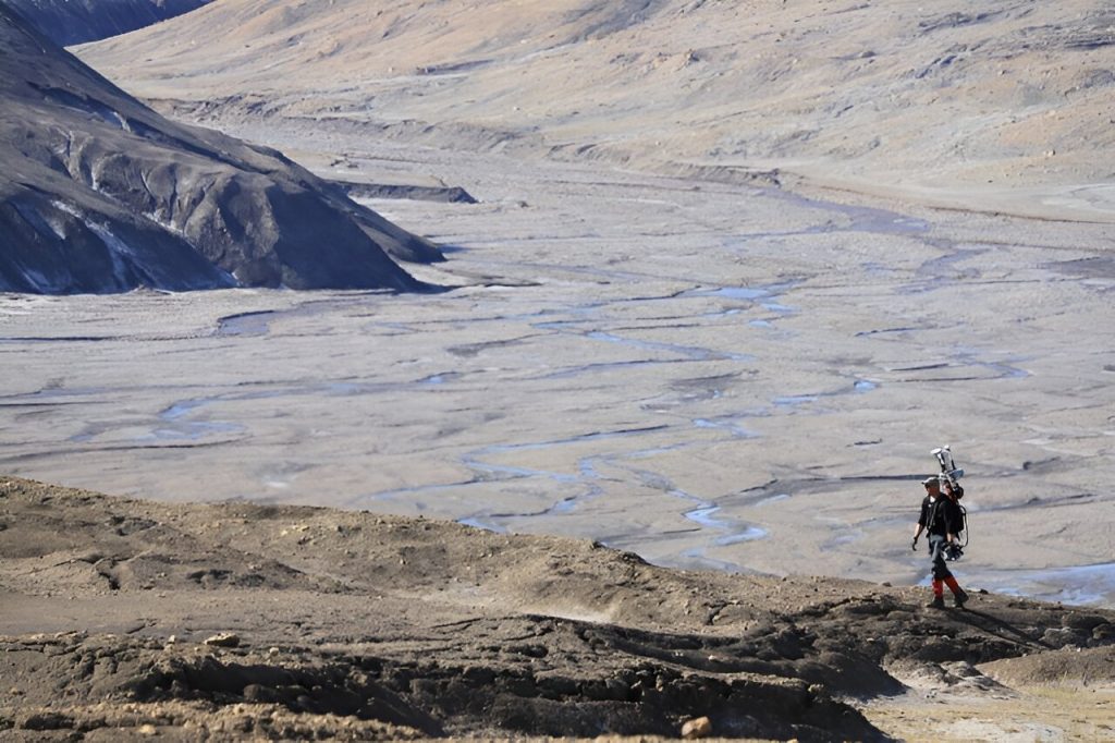
Researchers traveled to the uninhabited island of Axel Heiberg at the beginning of one of the most extreme summer warming waves on record. Their field research focused on the Muskox Valley, east of the Mueller Ice Sheet.
“Cascading” effects.
The study says scientists combined aerial photographs from 1959 with field observations to understand how the landscape on Axel Heiberg Island has evolved over 60 years. “These cascading effects could increase greenhouse gas emissions in the Arctic as soil organic carbon dissolves and permafrost retreats,” adds Mark Jelinek, co-author of the study and a professor at the University of British Columbia.
Using data collected by cutting-edge technologies, experts produced a digital elevation model (DEM) of a 400-metre-long section of the valley. “By modeling water movements in the landscape, we discovered that floodwater transported across interconnected polygons increases the likelihood of erosion and channel formation,” asserts Mr. Chartrand.
As such, the study reveals that valley lake floods and seasonal melting of snow and ground ice bring water that pools down the valley, creating the conditions necessary for sediment transport and the development of channel networks along the valley floor. However, the timing of floods during peak snowmelt can affect the extent of erosion.
According to Chartrand, higher air temperatures play a role in this, “We expect that erosion and sediment transport are sensitive to whether floods occur before or after a period of rising atmospheric temperatures. . . »
The researchers say a future challenge will be to apply this data to produce predictive physical models that will help understand how Arctic river networks will evolve over the coming decades, which are characterized by rising temperatures and intensifying climate variability.
“Action is becoming more urgent because expanding river networks will transport greater amounts of sediments as well as nutrients and minerals to fragile river basins and fisheries, with potentially serious consequences for wildlife, water and coastal populations,” the researchers concluded.

“Hardcore beer fanatic. Falls down a lot. Professional coffee fan. Music ninja.”
More Stories
It is better to preserve food without preservatives, but with yeast
He swallows an entire bowl of cheese balls in front of hundreds of spectators
Sylvain Cosette announces a surprise to the students of the Felix Leclerc School