


Death Valley is known for its extreme dryness and dangerous temperature records. Photo: NASA / JSC
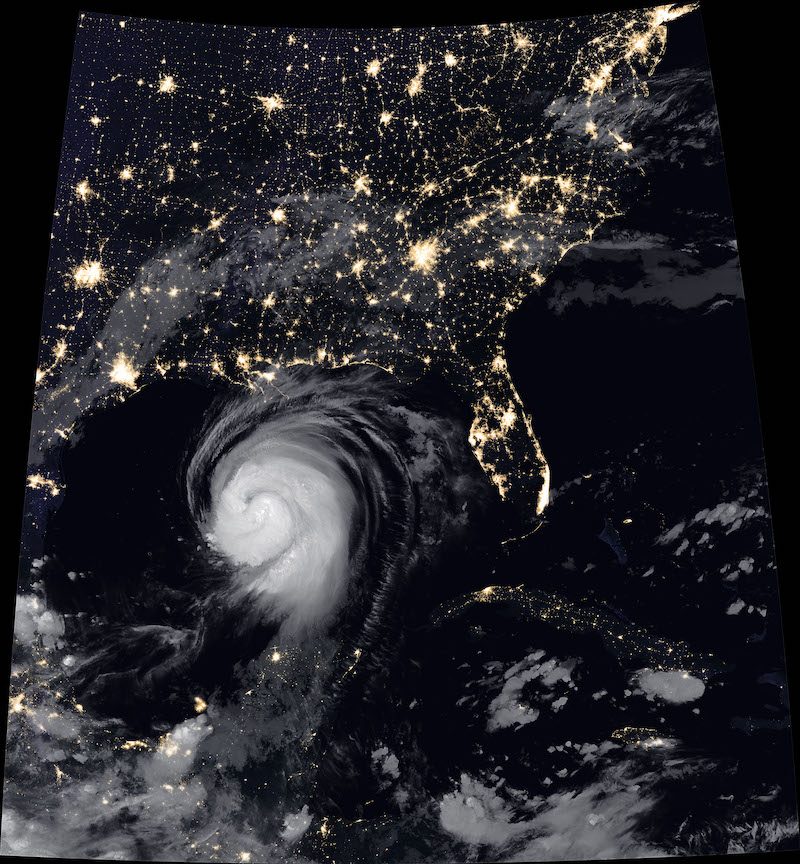
Hurricane Laura approaches the US Gulf Coast on August 26, 2020. Photo: Joshua Stevens / NASA Earth Observatory
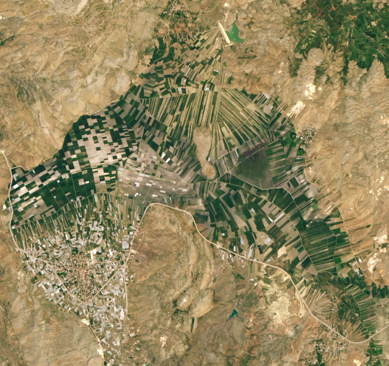
Agriculture is the main source of income in the rural areas of Turkey. There are approximately 3 million farms. The country is a major exporter of hazelnuts, chestnuts, apricots, cherries, figs, and olives. Photo: Lauren Dauphin / NASA’s Earth Observatory
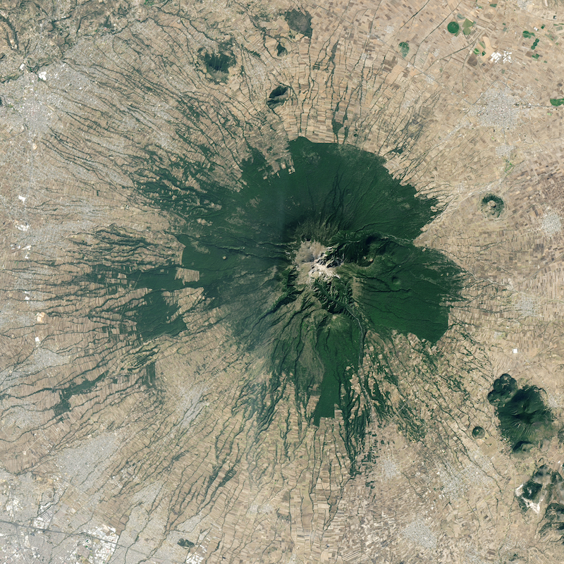
At 4,462 meters, the La Malinche volcano in Mexico rises above a mixture of towns, farms, and forests in the surrounding plains. Photo: Lauren Dauphin / NASA’s Earth Observatory
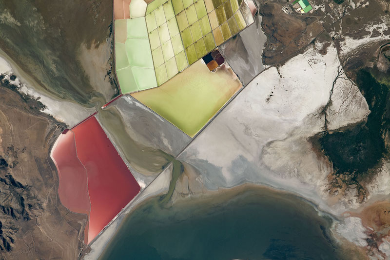
Over Utah, we can see salt marshes here whose color varies from blue to green to orange and red depending on the concentration of salt, bacteria and algae. In general, blue-colored ponds have lower salt levels than red or orange basins. Photo: Lauren Dauphin / NASA’s Earth Observatory
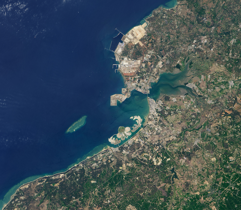
Ocean Flower Island grew in shallow coastal waters near Hainan, China. It stretches over nearly 8 square kilometers, making it among the largest artificial islands in the world. Image: NASA Earth Observatory
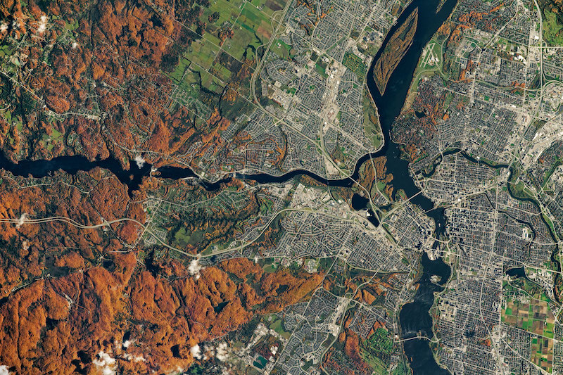
Colors are falling around Ottawa. We see Gatineau Park to the left, where leaves of sugar maple and walnut trees turn orange, red, and bronze. Photo: NASA-JSC
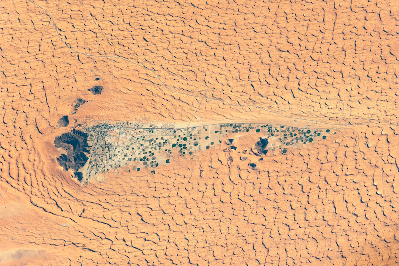
Sand dunes surrounding the oasis of Jubbah in the Kingdom of Saudi Arabia. Image taken from the International Space Station. Photo: NASA-JSC
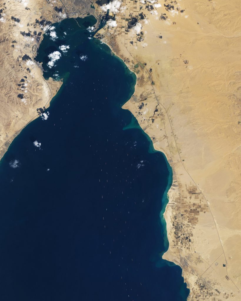
The Suez Canal is one of the most important shipping methods in the world. Sea traffic was halted for 6 days in March 2021 after a container ship ran aground. In this photo we see the boats waiting to be able to pass through the canal at the top. Photo: Lauren Dauphin, Joshua Stevens / NASA’s Earth Observatory
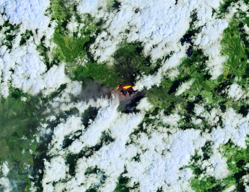
Guatemala is home to at least 36 volcanoes! Here, among the clouds, pours through the Pakaya volcano, which has regularly erupted since 1961. At the beginning of 2021, plumes of gas and ash rose to 4,500 m. Photo: Lauren Dauphin / NASA’s Earth Observatory
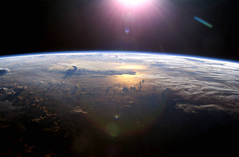
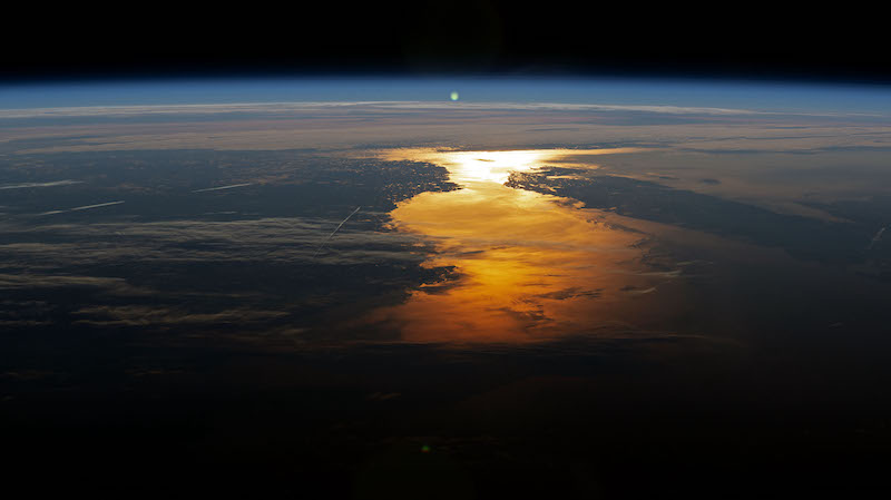
Aboard the International Space Station, astronauts enjoy this view of Earth as the sun sets over the Pacific Ocean. This photo was taken in 2003. Photo: NASA

“Hardcore beer fanatic. Falls down a lot. Professional coffee fan. Music ninja.”
More Stories
Why doesn't water come out of the bottle in free fall? Experience
Skyrmions, increasingly promising magnetic particles for future computers
A very simple tip for better brainstorming